AeDrone
Referencia:
Precio : Euros
AeDrone
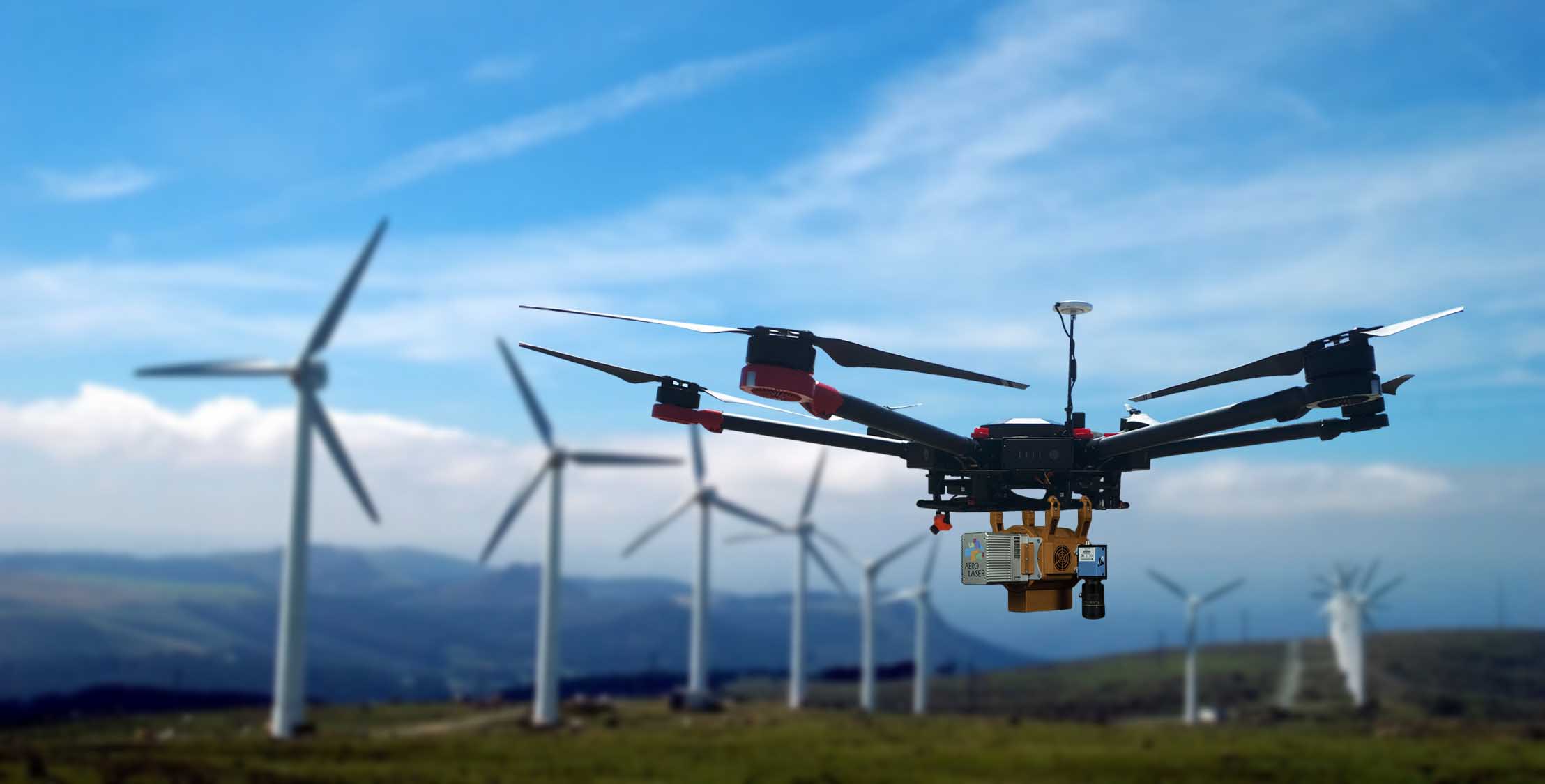
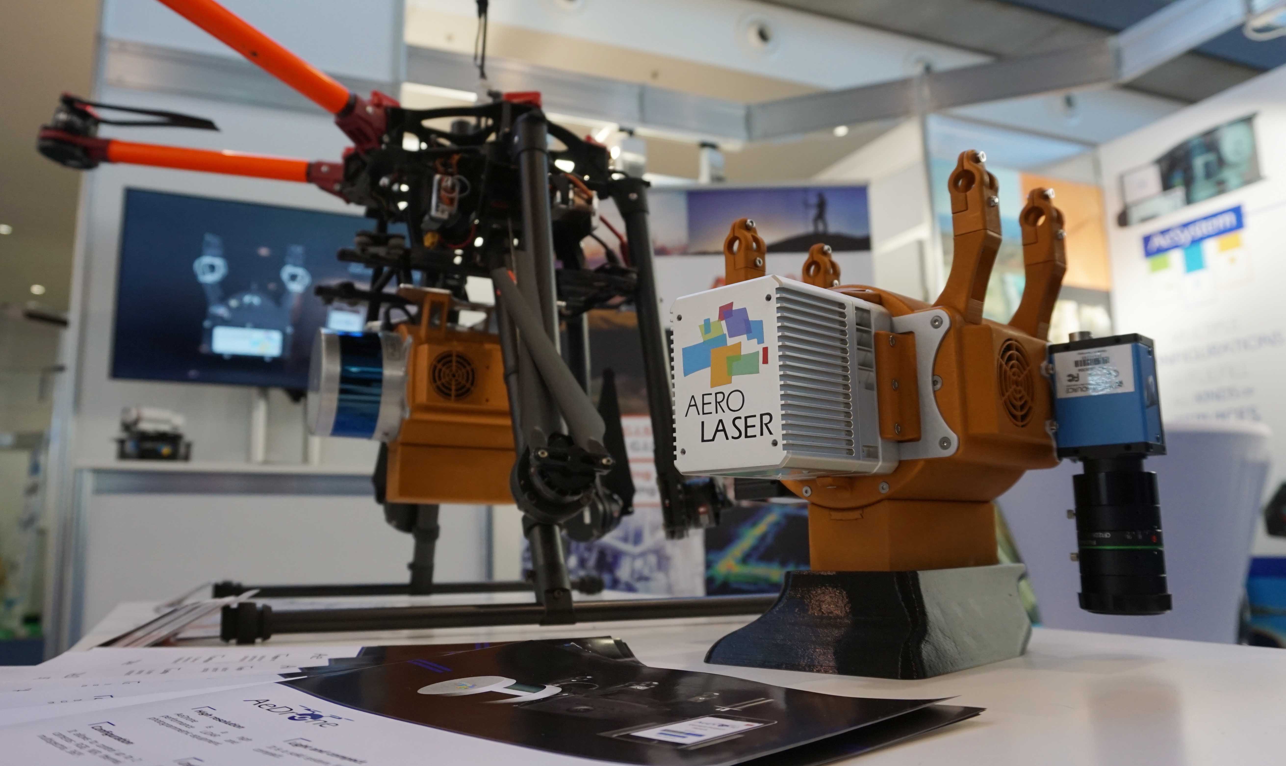
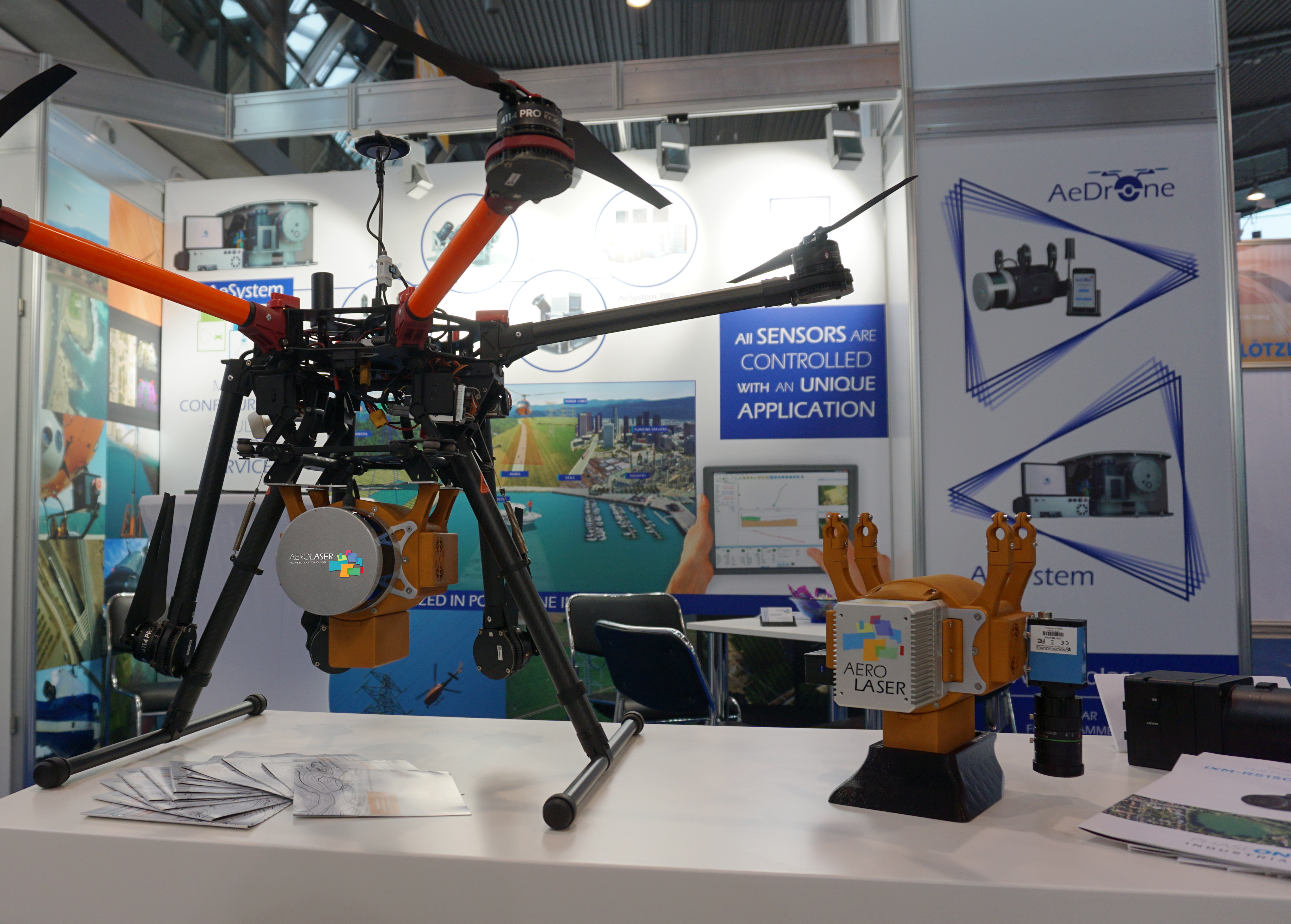
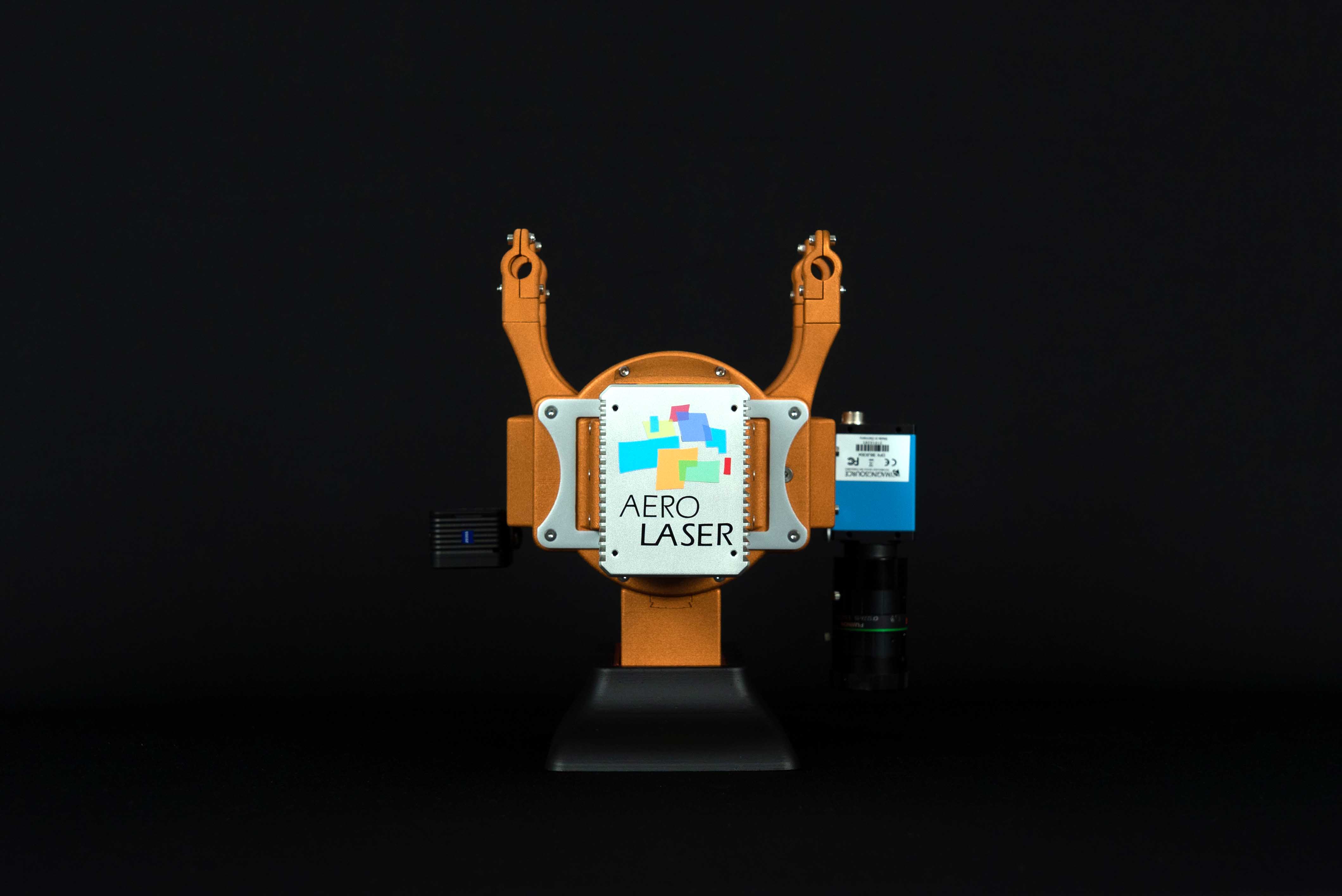
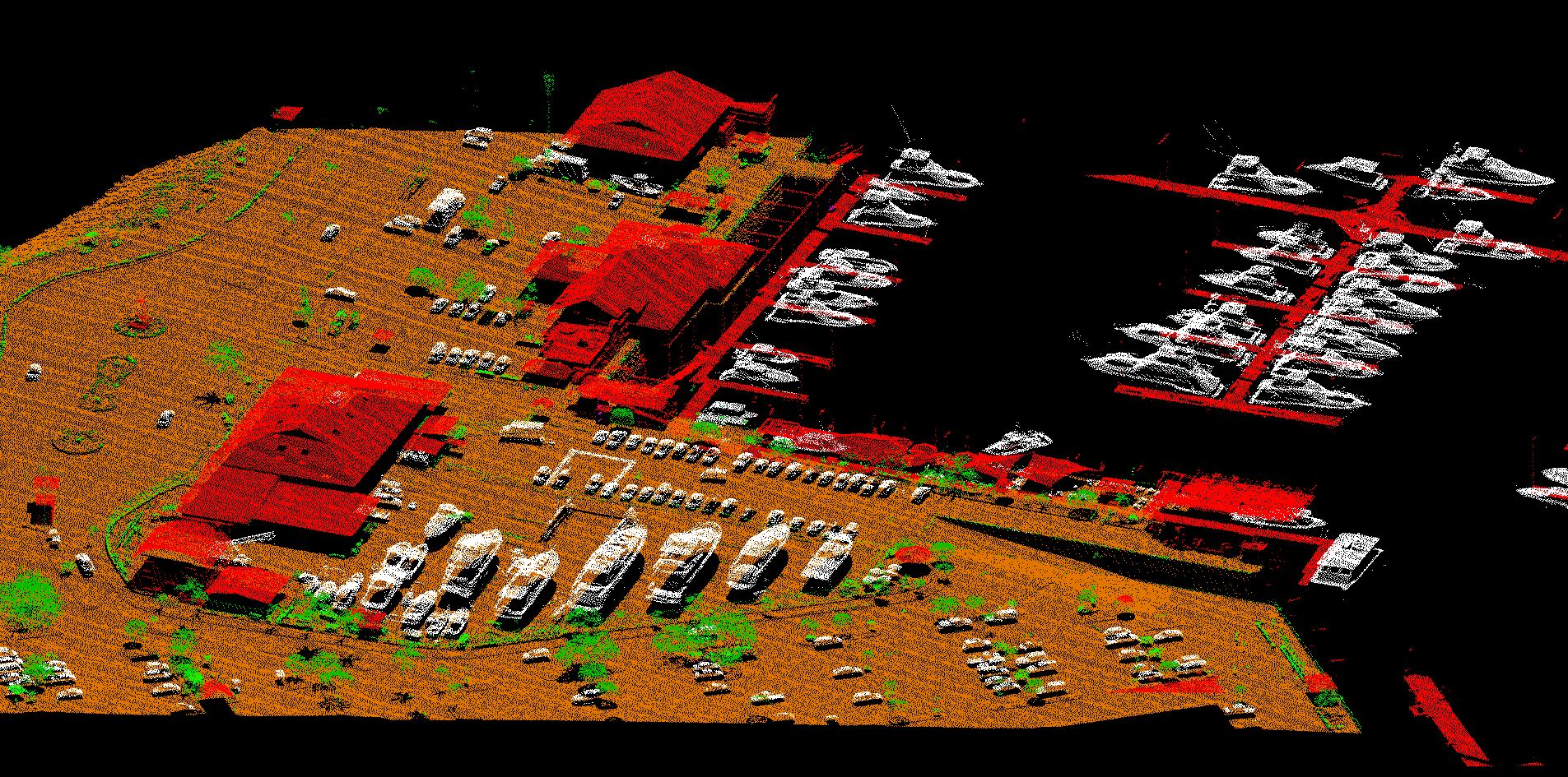
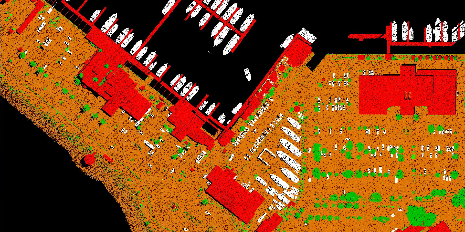
AeDrone, is our new system, the smallest and most versatile.
Its design and size make it a multifunctional equipment for aerial missions with drone or mobile mapping in different vehicles and even incorporate it into a backpack.
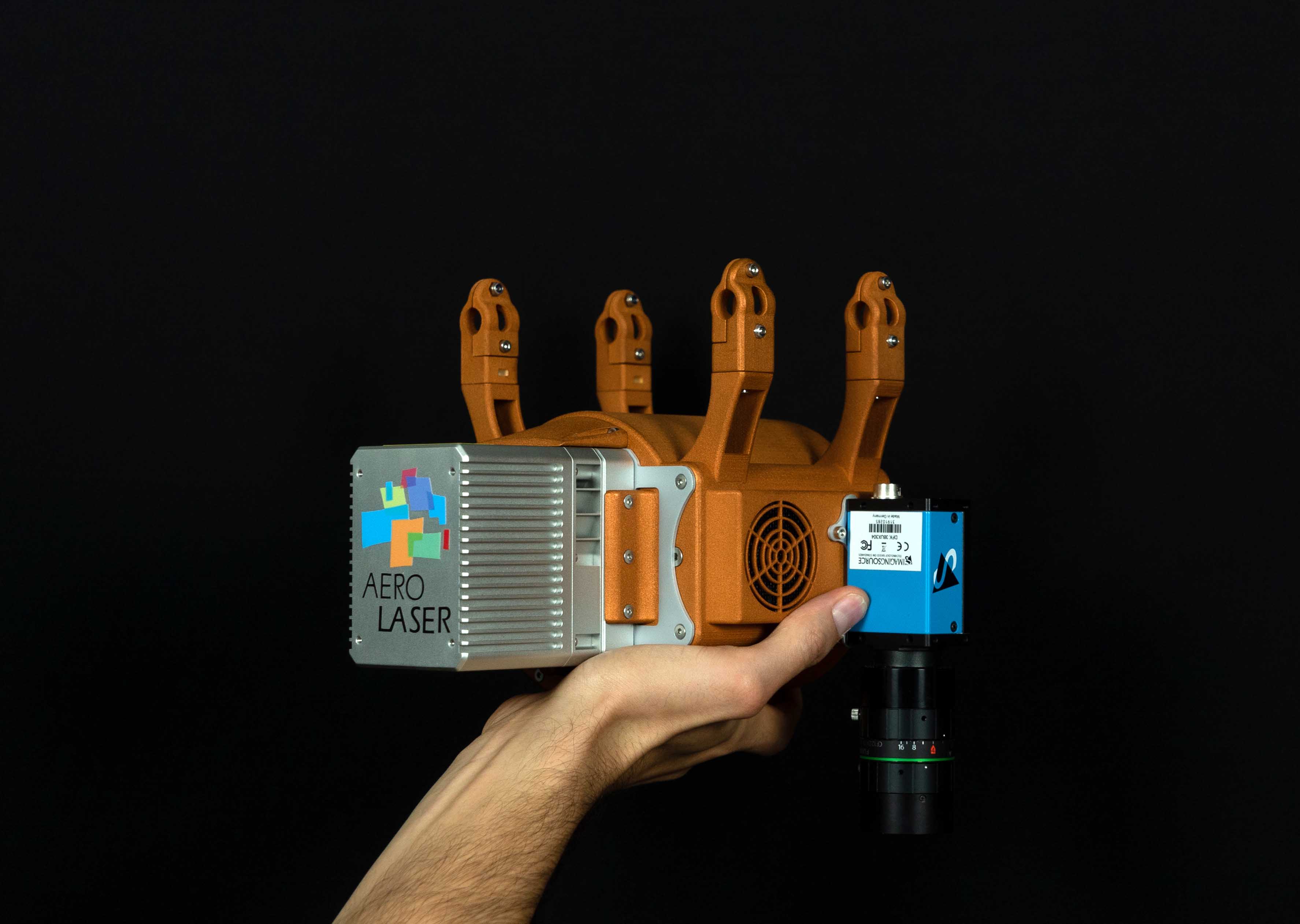
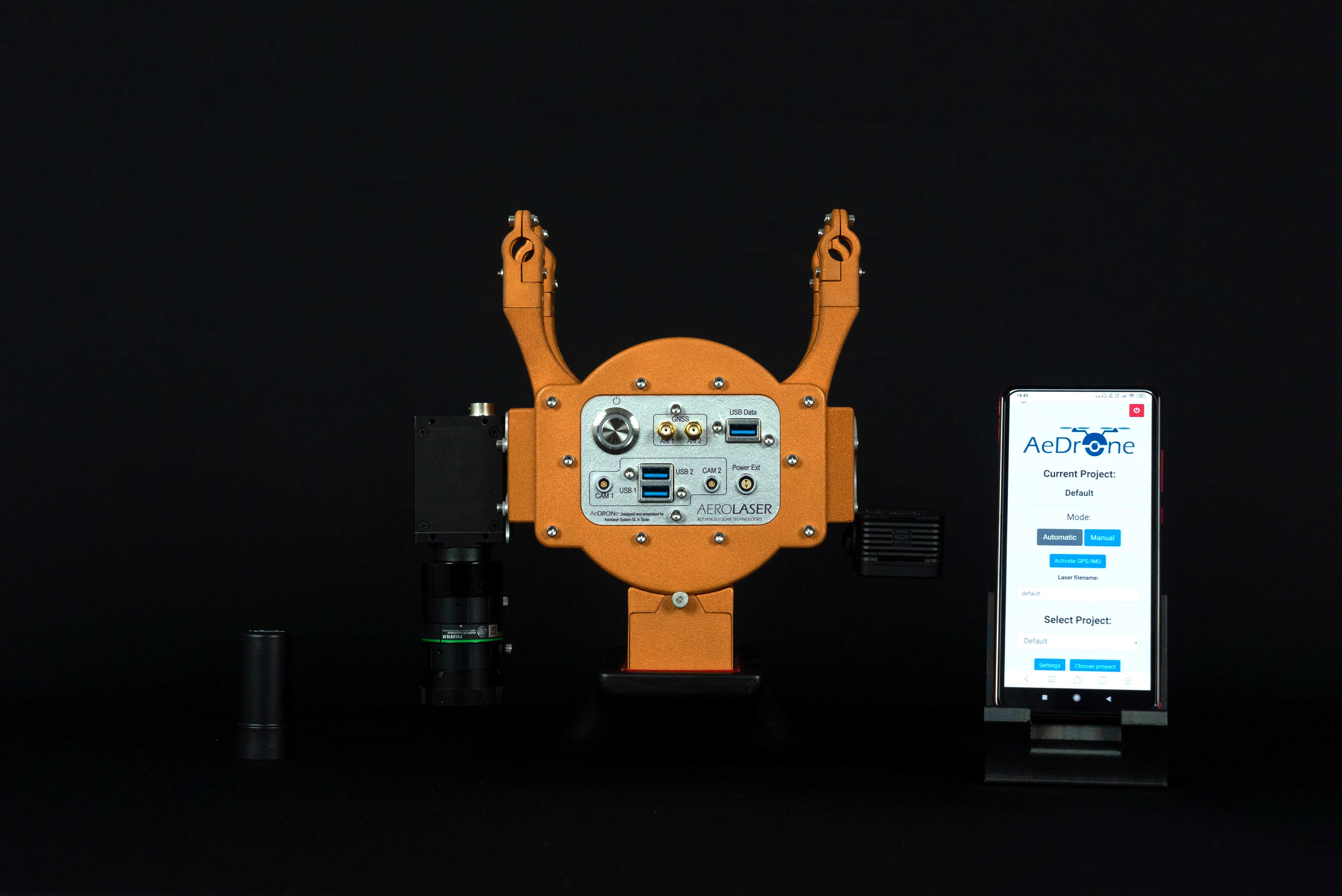
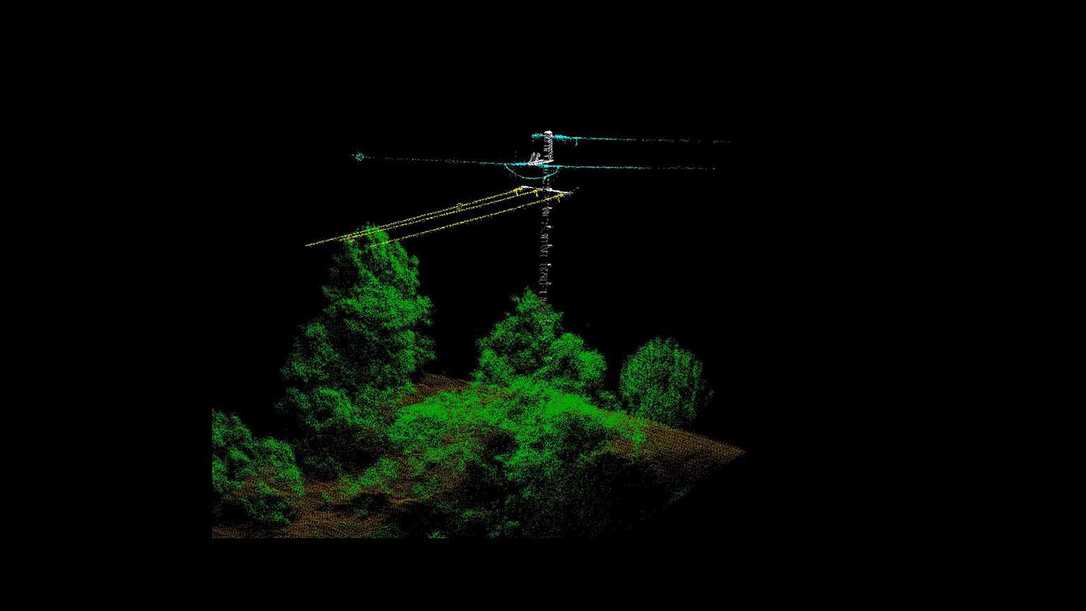
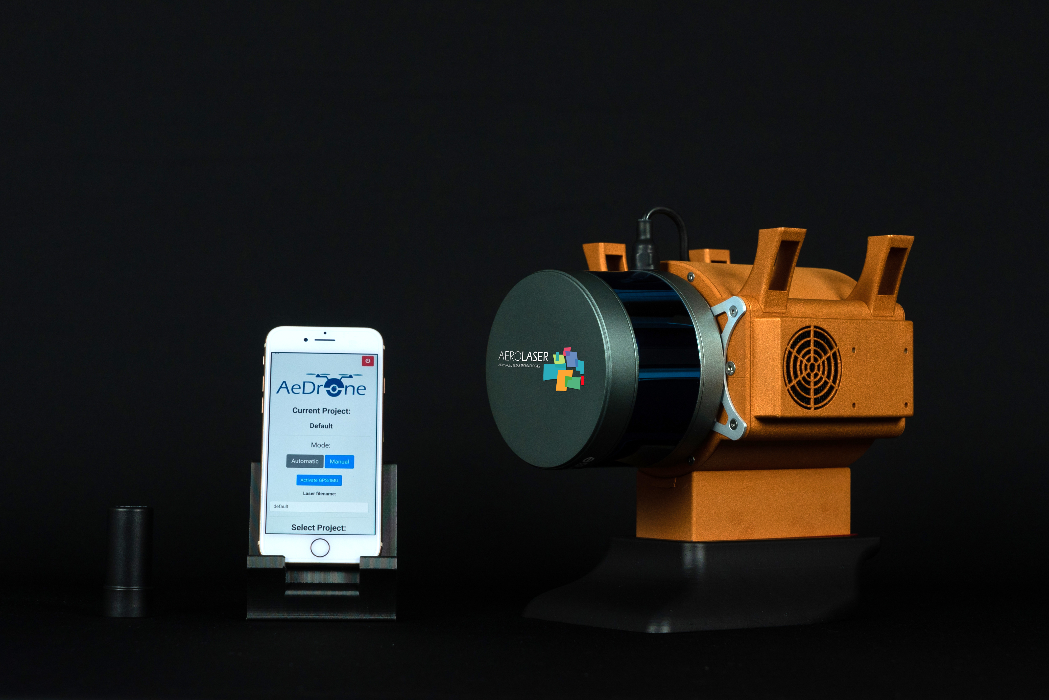
AeDrone consists of a laser scanner, an inertial control unit (AeCU) developed by Aerolaser, which controls, synchronizes all sensors and records GPS events. The AeCU integrates a GNSS and an IMU for data geocalisation. The PC controls the entire system in a simple and efficient way. Through a web application, using Wi-Fi connection it is possible:
-
Control, manage and configure all sensors during data acquisition.
-
Check the status of the IMU, GPS and laser.
-
Check the battery level.
-
Verify storage capacity (available / used).
-
Swich on and off the sensors.
In addition, it allows adding up to 2 RGB, NIR, multispectral and 360º cameras to the system.
All data is stored on an external USB, which facilitates its extraction for further data processing.
Downloads
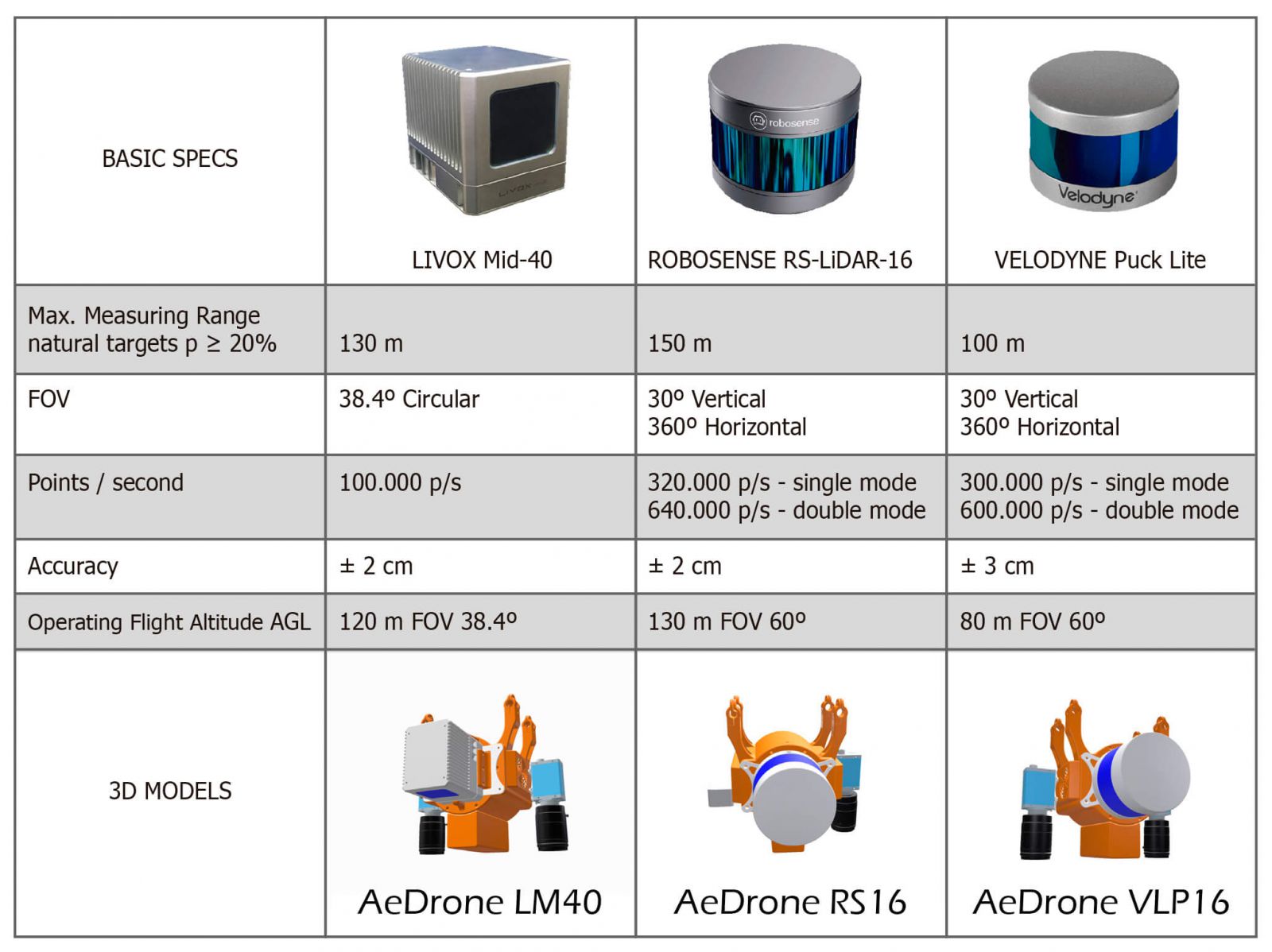
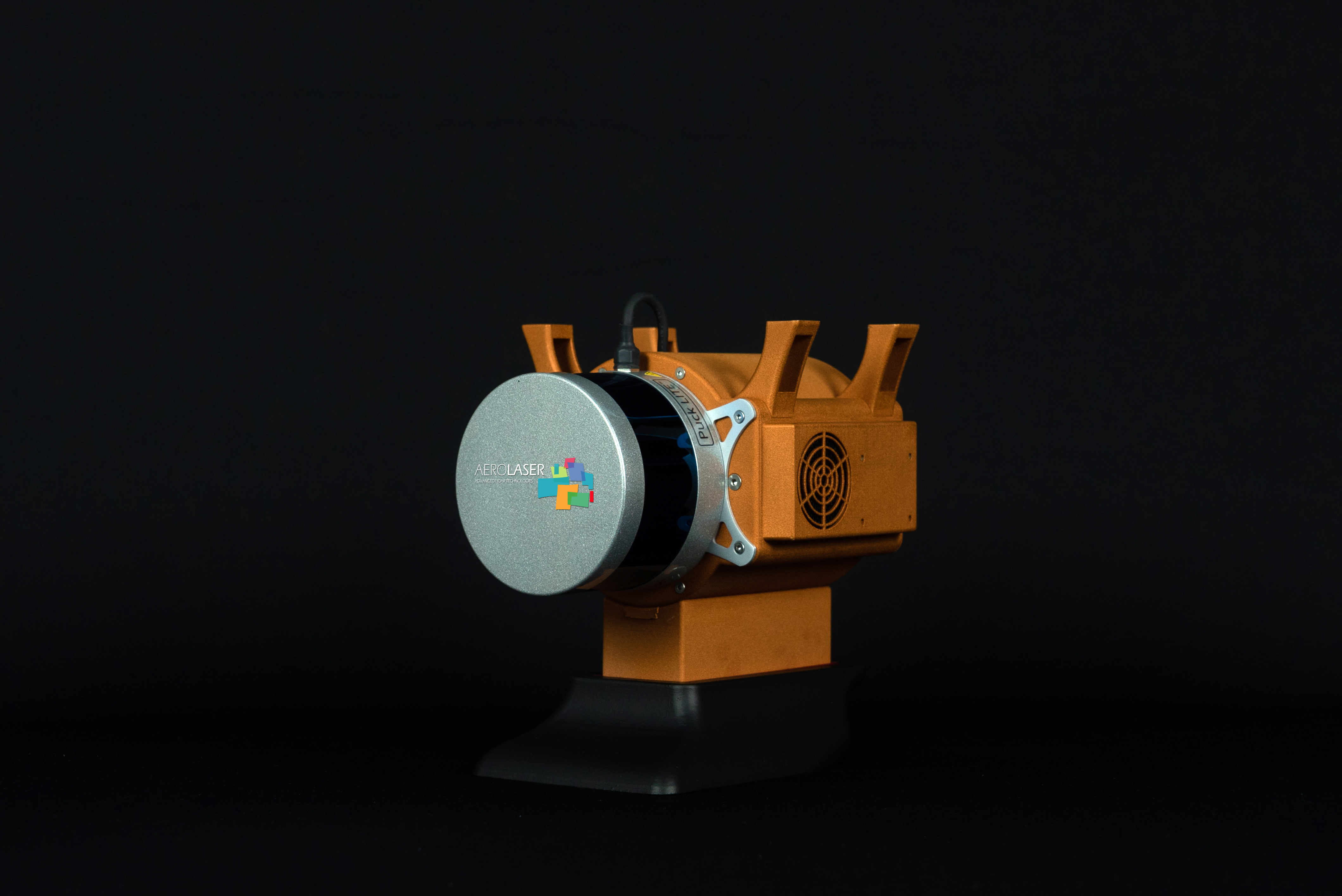
The system configuration is fully selectable. We have integrated 3 laser scanner models: Velodyne Puck Lite, Livox mid-40 and Robosense rs-lidar-16, several IMU: Stim and Epson and also camera models: Sony RX0 and DFK-38UX304.
In addition, other sensor models can be integrated at customer's request.
