Referencia:
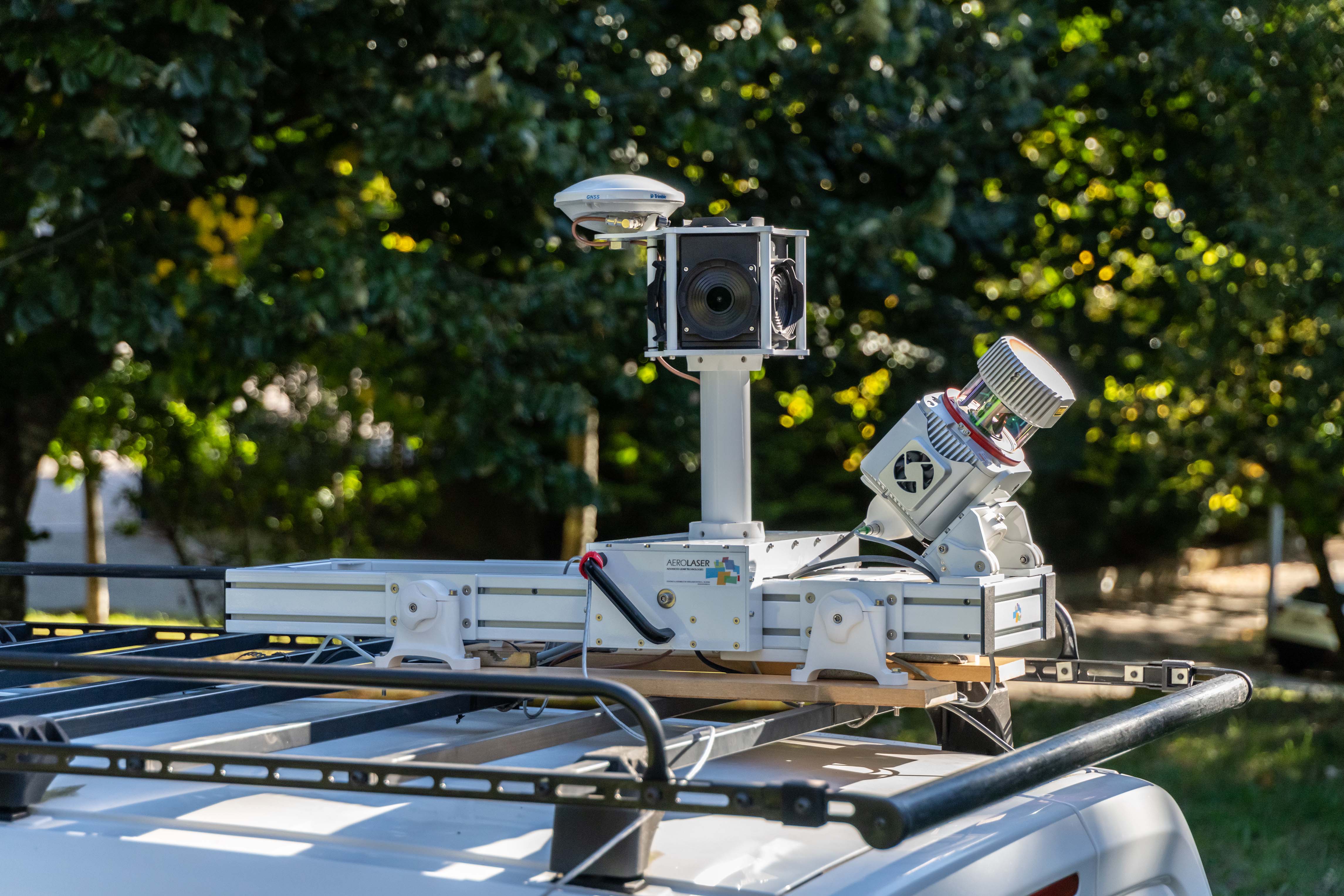
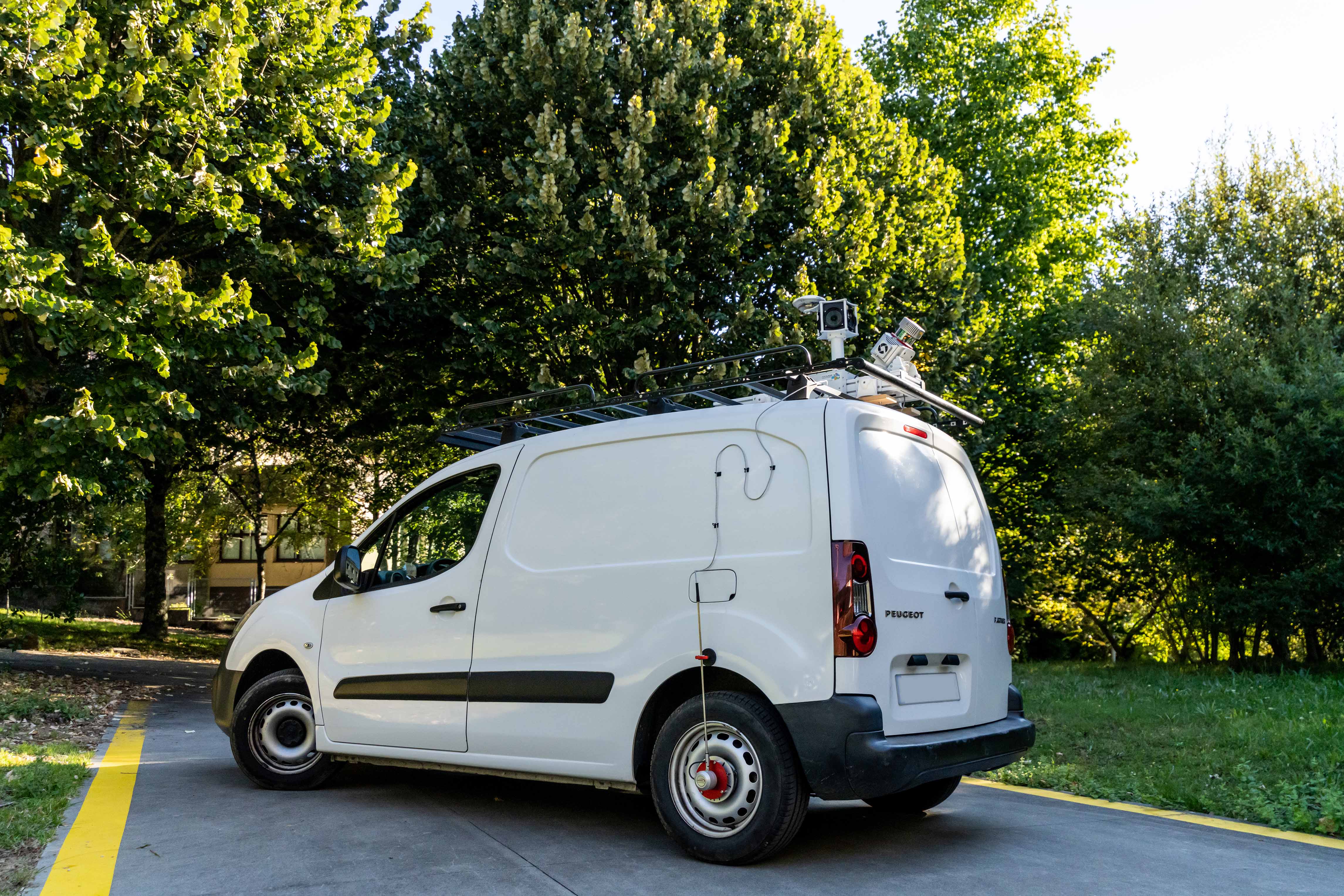
AeMobileMapping is a solution for ground mobile projects that uses LiDAR technology and 3D photography.
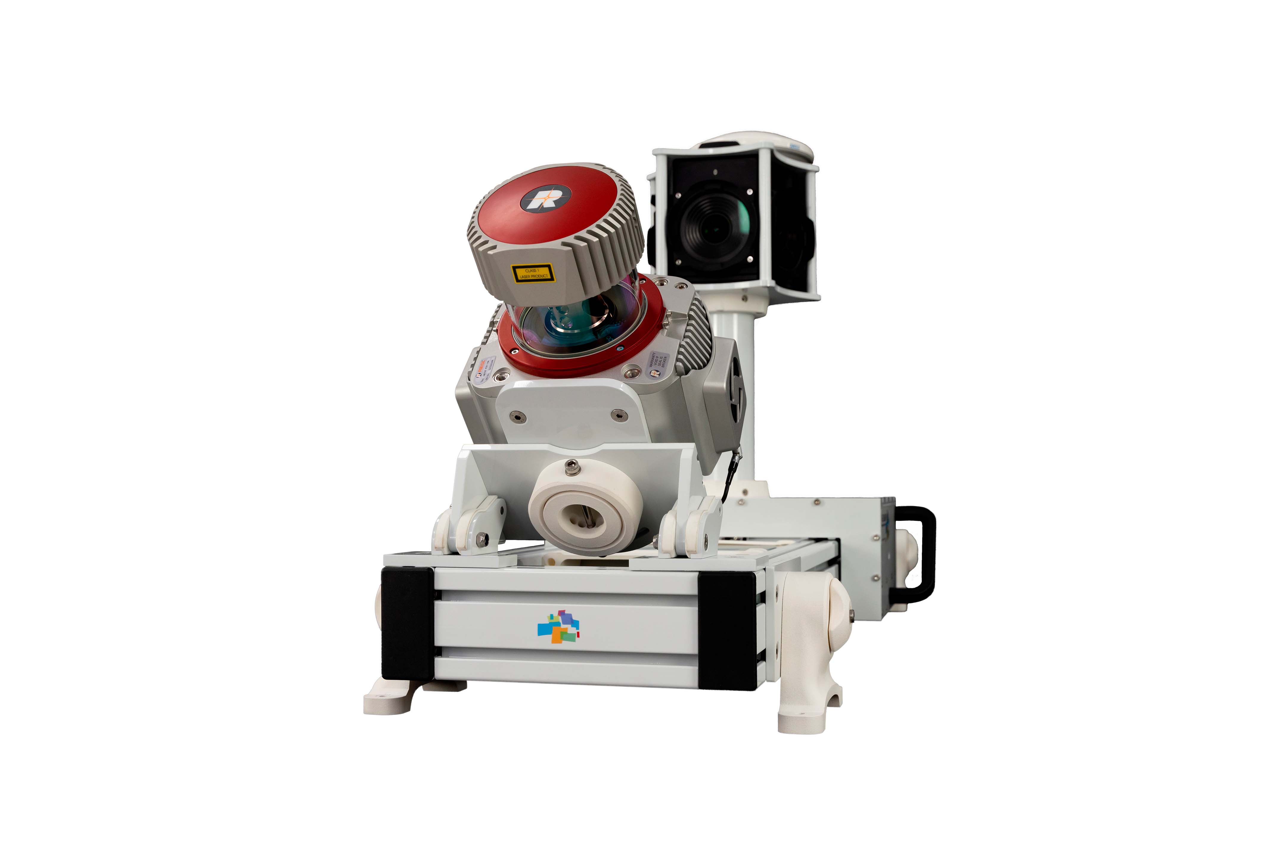
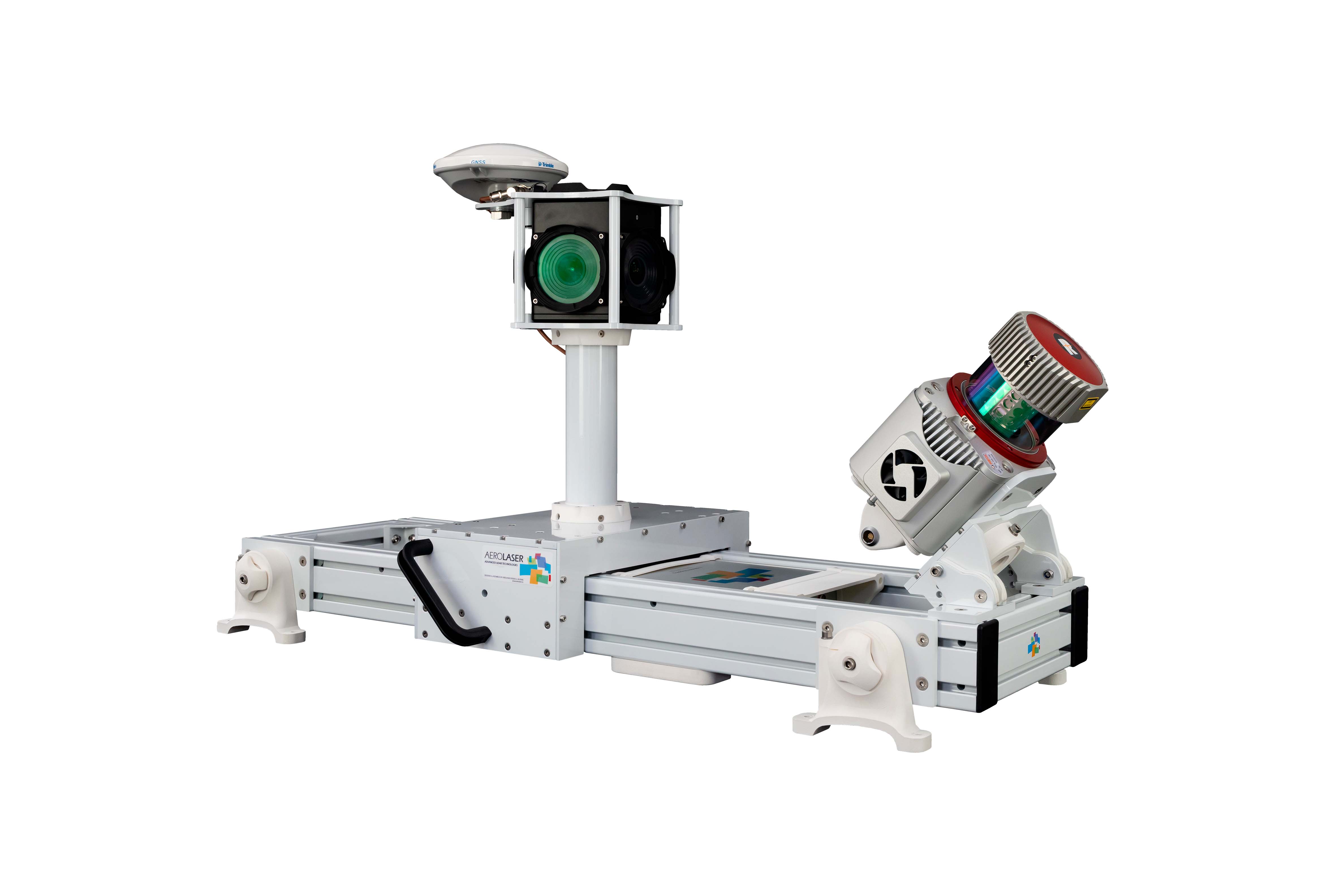
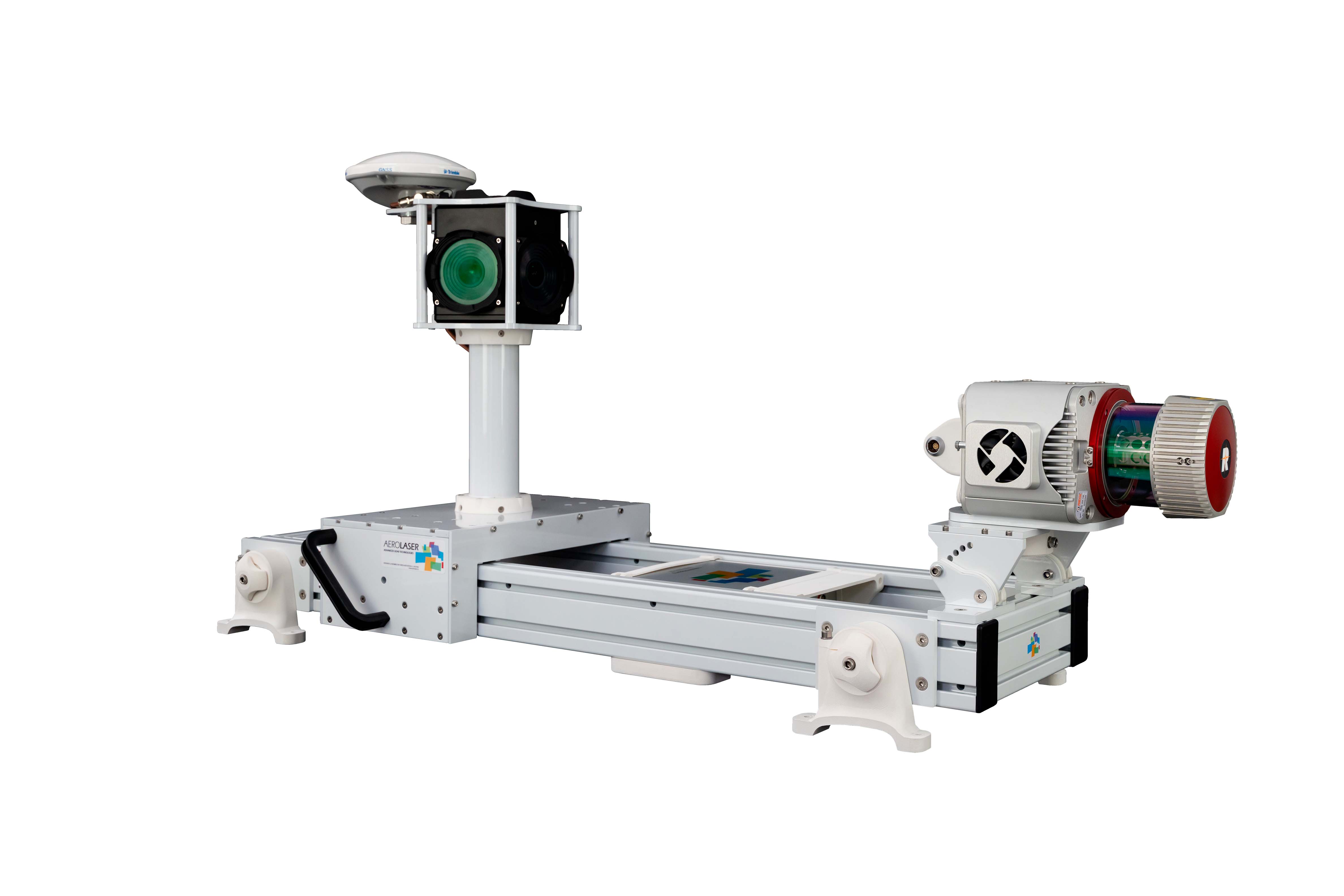
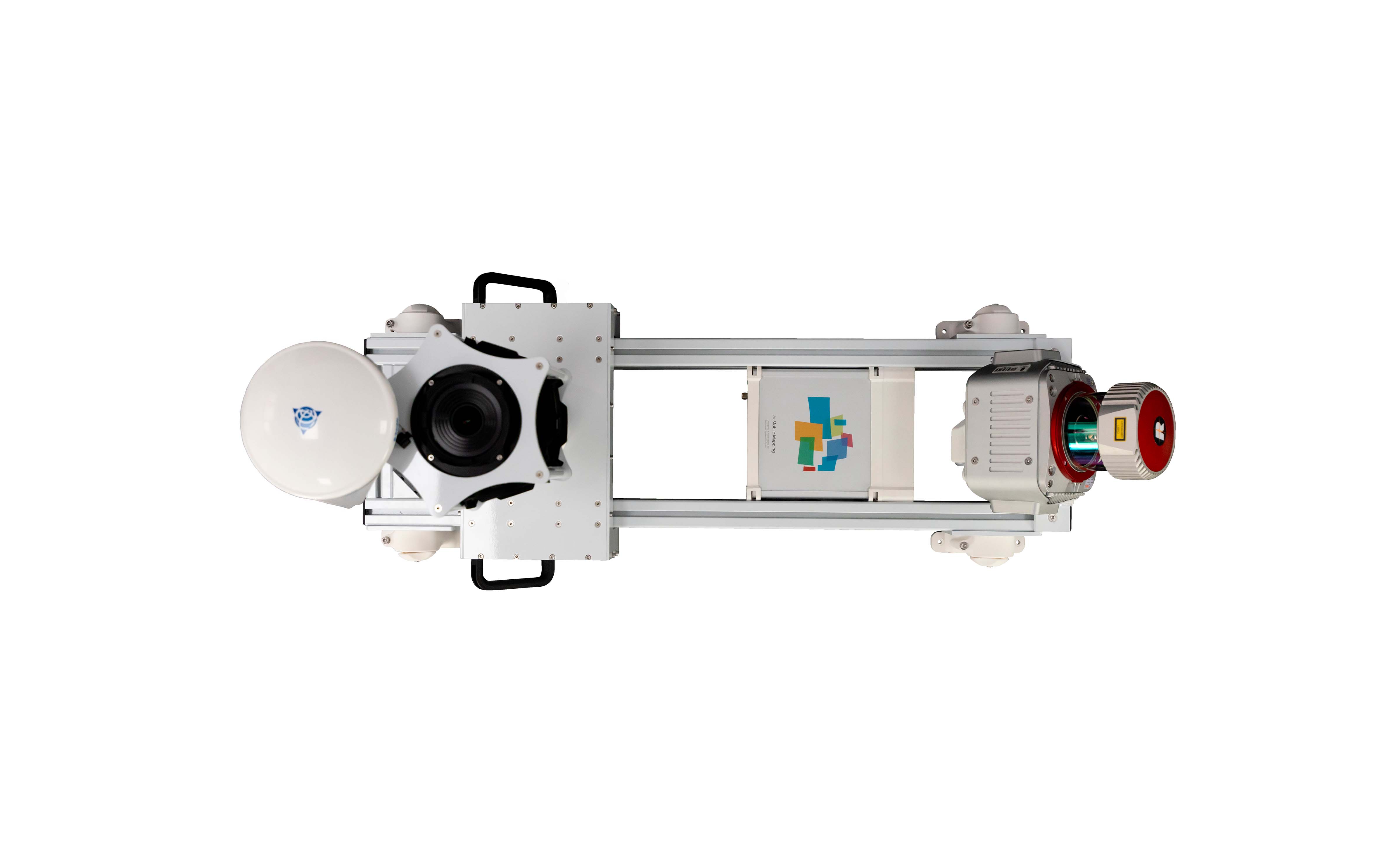
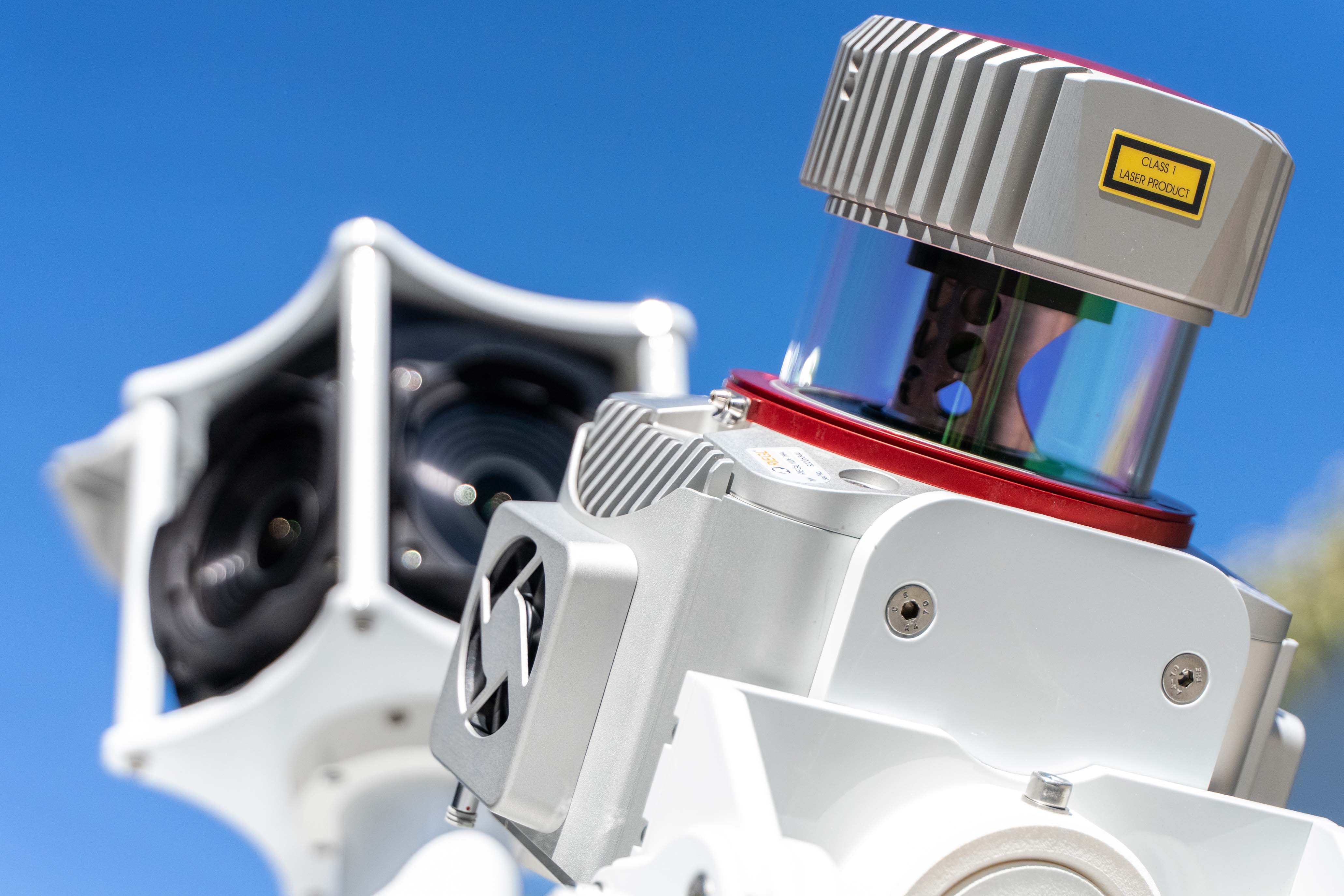
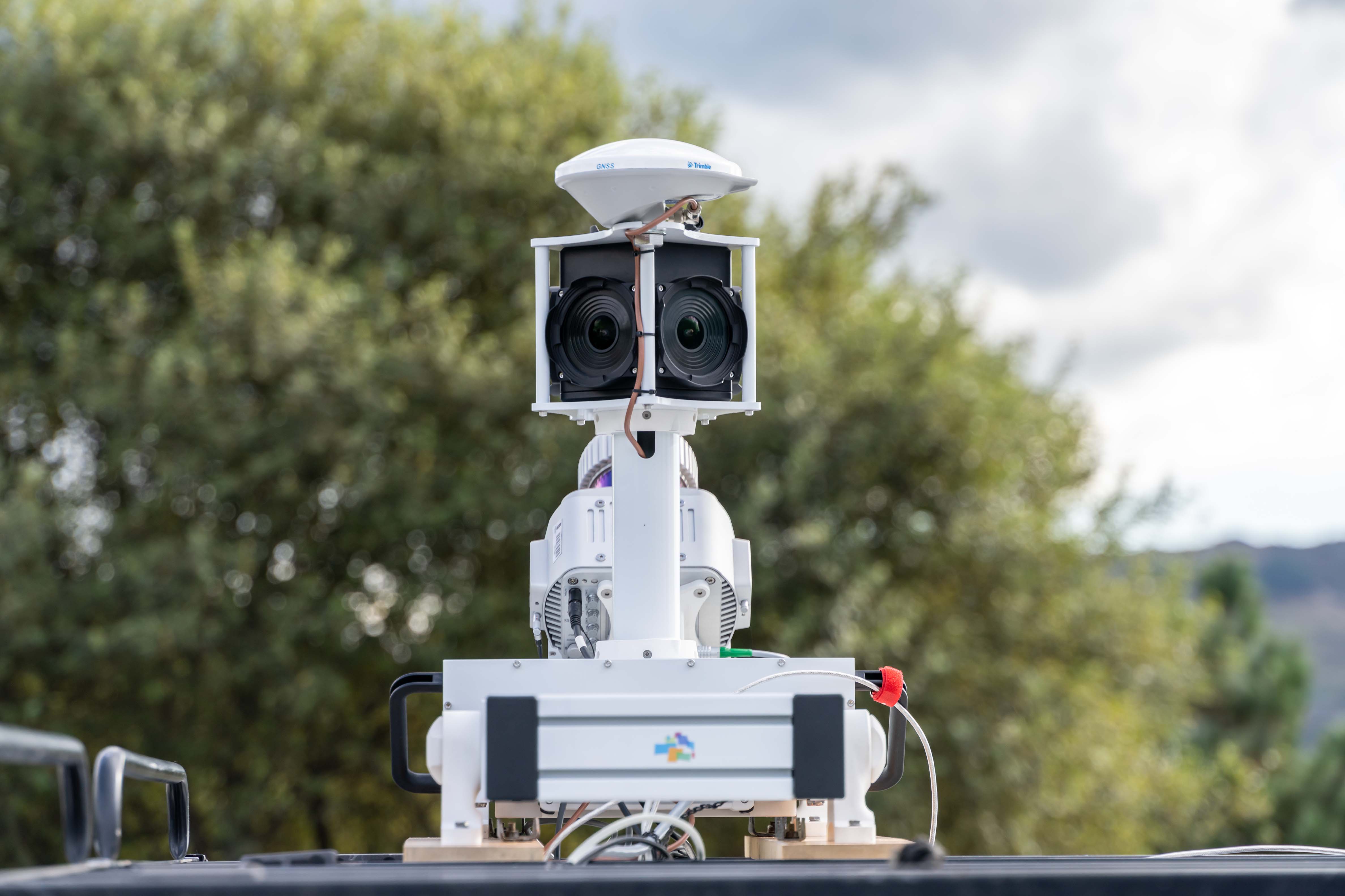
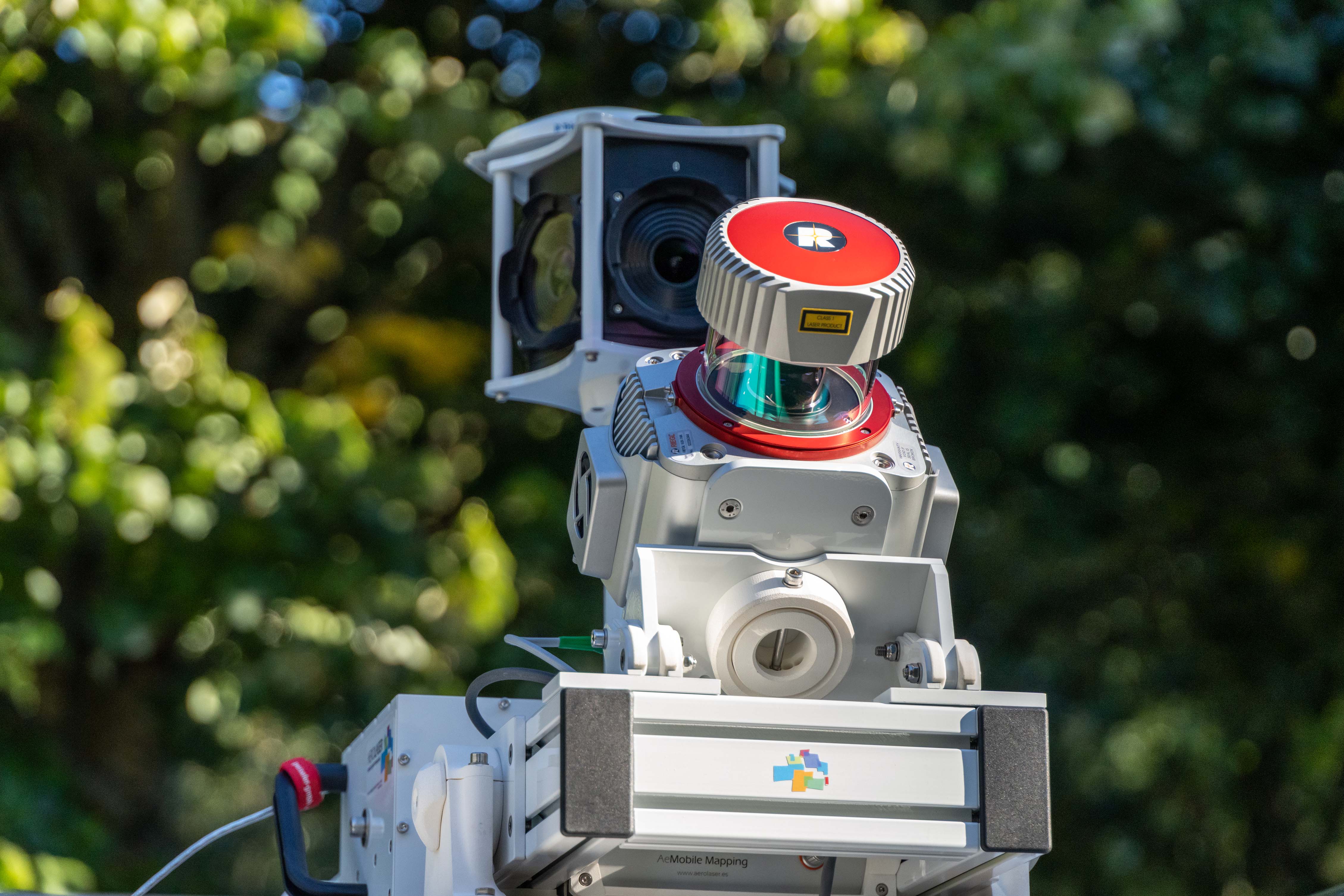
It is configured by the Riegl VUX-1HA laser scanner, it is a scanner with a 360º sweep, a pulse repetition rate of more than 1MHz and 5mm precision. For the 3D photography section we have the Ladybug 5+ camera, which offers high image quality and spherical precision. The 6 lens camera generates individual 30MP images and can achieve 8k30 and 4k30 content.
The scanner has 5 different yaw and pitch positions to cater for any type of terrestrial mapping, and 3 camera fixation positions in order to adapt it to any vehicle.
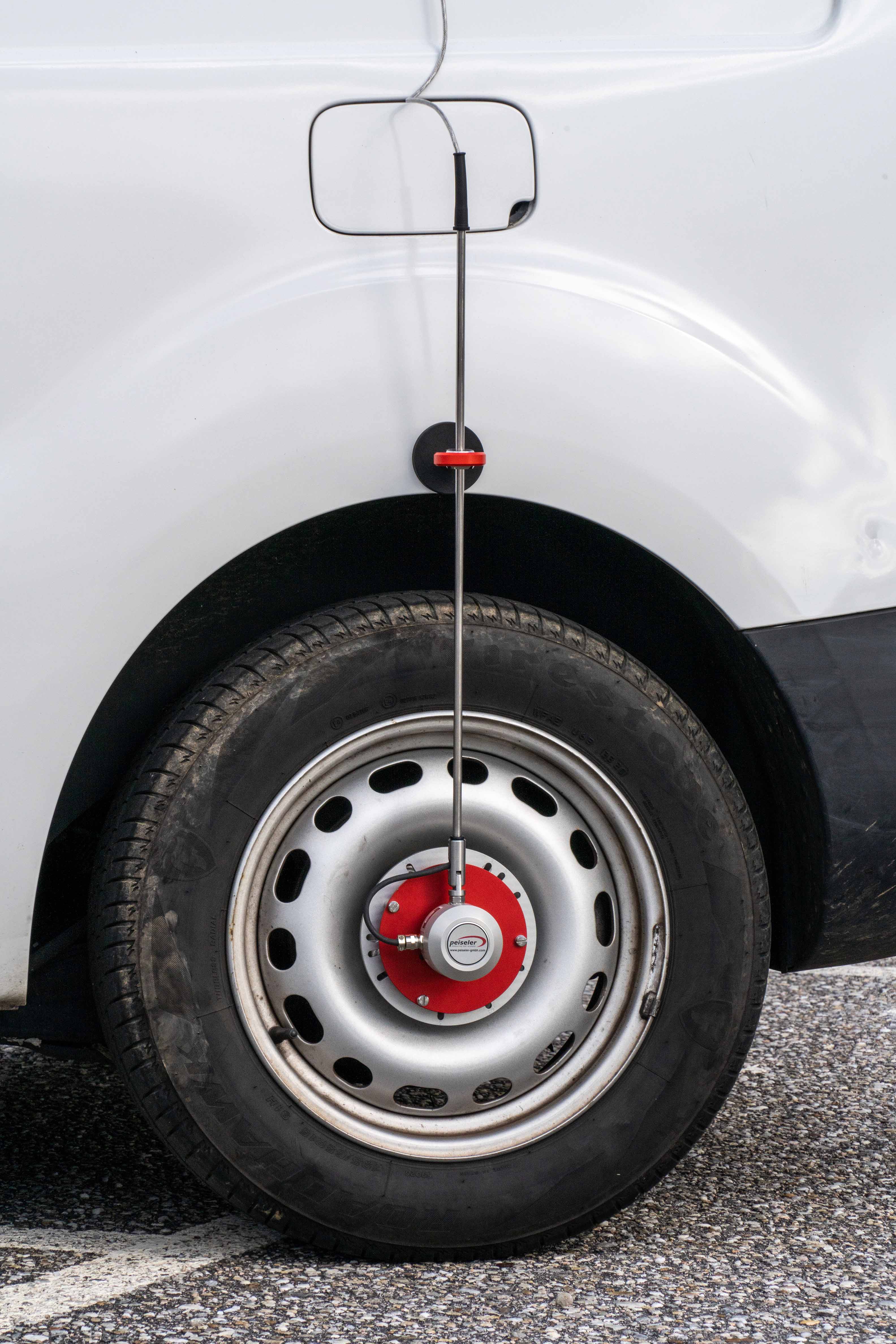
The odometer provides one more input for measurements with poor quality GPS navigation during data collection.
The control of the entire system is with a single computer in a 19 '' rack format to facilitate the fixing of the equipment inside the vehicle that transports it. Storing all the information on removable SSD hard drives.
Installation of the system on the vehicle is through the popular Thule fastening system.
The system provides solutions to projects to generate inventory of vertical elements, signage, structures, 360º images, virtual tours, 3D scenarios, road and rail maps, tunnel profile measurement ...